Summary
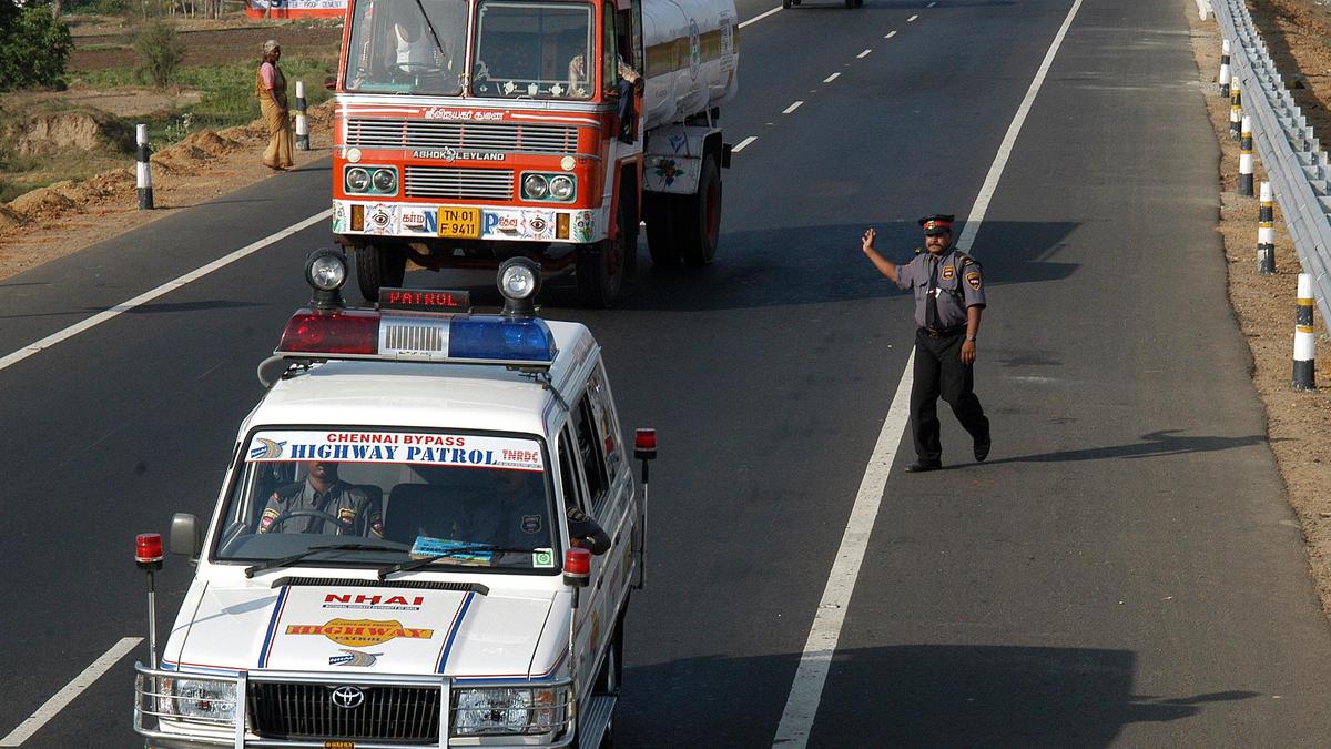
The National Highways Authority of India (NHAI) is launching a new system to track its emergency vehicles in real-time. This project involves equipping all highway patrol teams and ambulance crews with modern mobile devices. By using live GPS tracking, the agency aims to speed up emergency response times and make the roads safer for everyone. This move is a major step toward using technology to manage India’s vast highway network more effectively.
Main Impact
The primary goal of this initiative is to save lives by reducing the time it takes for help to arrive after an accident. In the past, locating the nearest ambulance or patrol car could be a slow process. With live tracking, dispatch centers can see the exact location of every vehicle on a digital map. This allows them to send the closest available unit to an emergency scene immediately. This change is expected to significantly improve the efficiency of highway safety operations across the country.
Key Details
What Happened
NHAI officials have decided to provide dedicated hardware to their field staff to ensure they are always connected. Patrol vehicle teams will be given Android-based smartphones, while ambulance crews will receive tablets. These devices will be loaded with specialized software designed to track their movements and allow for better communication with central command centers. This system ensures that the vehicles are actually where they are supposed to be and are ready to respond to calls.
Important Numbers and Facts
The project covers thousands of kilometers of national highways. By using standard Android devices and tablets, the NHAI is choosing a cost-effective way to upgrade its infrastructure. The tracking data will be monitored 24 hours a day. This will help the NHAI keep a close eye on the performance of the private companies that are often hired to manage these patrol and medical services. If a vehicle stays idle for too long or goes off its assigned route, the system will flag it for review.
Background and Context
India has one of the largest road networks in the world, but it also faces a high number of road accidents every year. For a long time, the "Golden Hour"—the first hour after a traumatic injury—has been a major focus for safety experts. If a victim gets medical help within this first hour, their chances of survival increase greatly. However, on long stretches of highway, finding and reaching victims quickly is a huge challenge. This new tracking system is designed to solve that specific problem by removing delays in the dispatch process.
Public or Industry Reaction
Road safety experts and regular commuters have reacted positively to the news. Many people feel that the current system for highway help is sometimes unreliable or slow. By introducing transparency through GPS tracking, the public feels more confident that help will actually show up when called. Industry experts also point out that this data will be very useful for future planning. It will show which parts of the highway have the most accidents and where more ambulances might be needed in the future.
What This Means Going Forward
Looking ahead, the NHAI plans to use the data collected from these devices to improve road design. By analyzing where patrol cars and ambulances are most active, they can identify dangerous "black spots" on the highways. These are areas where accidents happen more often than usual. Once these spots are found, engineers can work on fixing the road, adding better signs, or improving the lighting. This shift toward data-driven safety management could lead to a permanent decrease in highway fatalities over the next few years.
Final Take
This new tracking facility is a practical and smart use of everyday technology. By giving simple tools like phones and tablets to emergency workers, the NHAI is making the road network much more organized. It shows a clear commitment to traveler safety and sets a new standard for how emergency services should operate on national roads. For the millions of people who use these highways every day, this is a very welcome change.
Frequently Asked Questions
How will the live tracking help drivers?
It helps drivers by ensuring that the nearest ambulance or patrol car is sent to them as quickly as possible during an emergency, reducing wait times during critical moments.
What devices will the emergency teams use?
Patrol teams will use dedicated Android smartphones, and ambulance crews will be equipped with tablets to track their location and communicate with headquarters.
Will this system be used to monitor the workers?
Yes, the system will help the NHAI ensure that patrol and medical teams are following their assigned routes and staying active during their shifts, which improves overall service quality.