Summary
Ahmedabad and several parts of Gujarat experienced a sudden change in weather early on March 19, 2026. Strong winds and heavy dust storms hit the city, causing visibility issues for drivers and temporary power outages in some neighborhoods. The weather department has issued alerts for unseasonal rain and thunderstorms across the state for the next 48 hours due to a new weather system. While the winds brought a drop in temperature, they also created challenges for daily commuters and local residents.
Main Impact
The most immediate impact of this weather shift was a significant drop in temperature, providing relief from the recent heat. However, this came at a cost. In Ahmedabad, wind speeds reached between 30 and 40 kilometers per hour, kicking up massive clouds of dust. This led to poor visibility on major roads, making it dangerous for people riding bikes and driving cars. Additionally, the strong gusts caused power failures in certain parts of the city, disrupting morning routines for many families.
Key Details
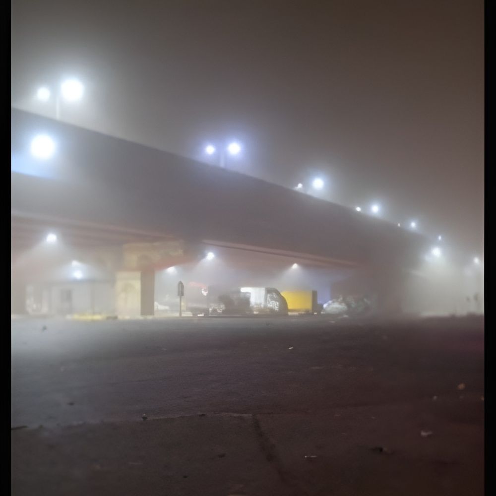
What Happened
Early in the morning, the sky over Ahmedabad turned grey, not just with clouds but with thick dust. Areas like Ujala Circle and Vanzar were the hardest hit by these dust storms. The wind was so strong that it felt like a mini-cyclone for those outdoors. Pedestrians had to cover their faces, and many vehicles had to pull over because they could not see the road ahead. The dust also entered homes and shops, creating a mess for local business owners.
Important Numbers and Facts
The weather department, known as the IMD, has provided specific data regarding this event. In Ahmedabad, winds were recorded at 40 kilometers per hour. In North Gujarat, the situation is expected to be more intense, with wind speeds potentially reaching up to 61 kilometers per hour. The forecast suggests moderate rainfall between 5 and 15 millimeters per hour in areas under an "Orange Alert." In "Yellow Alert" zones, light rain of less than 5 millimeters per hour is expected. There is also a 30% to 60% chance of lightning strikes in various districts.
Background and Context
This sudden change is caused by something called an "upper air cyclonic circulation system." In simple words, this is a swirling movement of air high in the atmosphere that brings in moisture and creates unstable weather. Usually, March is a month where the heat starts to increase in Gujarat. When a cold or moist system moves in during this time, it clashes with the warm air, leading to strong winds, dust, and unseasonal rain. This is often called "Mavthu" in the local language. While the cool air feels good, unseasonal rain can be very bad for farmers who are ready to harvest their crops like wheat and mustard.
Public or Industry Reaction
People in Ahmedabad had mixed feelings about the weather. Many enjoyed the break from the heat, but the dust storms were a major complaint. On social media, residents shared videos of the dust clouds near Ujala Circle, warning others to drive slowly. The power companies received several calls about electricity cuts in the Vanzar area. Farmers across the state are expressing concern. Rain at this stage of the season can damage standing crops, leading to financial losses. Local authorities have advised people to stay indoors during high winds to avoid accidents from falling trees or signboards.
What This Means Going Forward
The next 24 to 48 hours are critical for Gujarat. The weather department predicts that the rain will spread to South Gujarat and the Saurashtra region. Districts like Surat, Rajkot, Bhavnagar, and Junagadh are likely to see cloudy skies and light showers. North Gujarat districts, including Banaskantha and Patan, remain on high alert for stronger storms. By March 20, the weather system is expected to move away, and the skies should start clearing up by March 21. Until then, residents should be prepared for sudden changes in weather and potential lightning.
Final Take
The sudden dust storms and wind in Ahmedabad serve as a reminder of how quickly nature can change. While the cool breeze is a welcome break from the summer sun, the risks of low visibility and lightning should not be ignored. It is important for everyone to stay updated with local weather news and take basic safety steps, like avoiding open fields during a storm and driving carefully on dusty roads. The state is expected to return to its normal sunny weather by the weekend.
Frequently Asked Questions
Why did Ahmedabad have a dust storm today?
A weather system called a cyclonic circulation moved over Gujarat. This caused strong winds that picked up dry soil from the ground, creating dust storms and reducing visibility across the city.
Which areas in Gujarat are under an Orange Alert?
North Gujarat districts, including Banaskantha, Patan, Mehsana, and Sabarkantha, are under an Orange Alert. These areas may see moderate rain, lightning, and very strong winds.
When will the weather return to normal?
The weather department expects the rainy conditions to last until March 20. The sky is predicted to clear up and the weather should return to normal starting from March 21.