By Weather Desk | Environment and Climate Beat
The skies over Kolkata could turn angry sooner than expected. A cyclonic circulation now swirls over the Bay of...
Admin
The Tasalli
728 x 90Header Slot
TL;DR — Quick Summary
A cyclonic circulation over the Bay of Bengal has prompted a heavy rain alert for Kolkata and south Bengal. The region faces the risk of waterlogging, traffic disruption and travel delays. Residents should track official weather updates and plan movements carefully until the system passes.
Key Facts
Main Update
A cyclonic circulation is active over the Bay of Bengal, according to the reported weather alert.
Impact
Heavy rain has been flagged for Kolkata and large parts of south Bengal.
Official Response
No independent IMD bulletin has been verified for this report; the alert itself is the primary source.
Current Status
The system is being watched — rainfall intensity, peak timings and district coverage remain unconfirmed.
What Next
Clarity is expected from weather authorities as the circulation evolves over the coming days.
By Weather Desk | Environment and Climate Beat
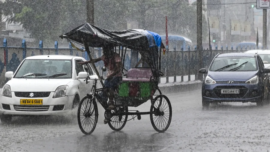
The skies over Kolkata could turn angry sooner than expected. A cyclonic circulation now swirls over the Bay of Bengal, and the weather alert attached to it puts Kolkata and large parts of south Bengal on notice for heavy rain. For a city that knows the chaos of a sudden downpour — waterlogged intersections, stranded buses, delayed local trains — this is more than a forecast. It is a warning to plan ahead.
What the reported alert says about rain over Kolkata and south Bengal
The reported alert says a cyclonic circulation is currently active over the Bay of Bengal, with heavy rain expected across Kolkata and south Bengal. Exact rainfall totals, precise timings and the full district list have not been confirmed in this report. What is clear is that this system has already crossed the threshold for an official rain alert, which means forecasters are treating it as a genuine concern.
Why a Bay of Bengal circulation can bring heavy rain
A cyclonic circulation is a swirling pattern of winds around a low-pressure area. When it positions itself over the Bay of Bengal, it pulls warm, moisture-laden air from the sea toward the coast. Kolkata and south Bengal sit directly in that path. That geography is precisely why this kind of system so often translates into intense, sometimes continuous rain over a short period, raising the risk of waterlogging in low-lying neighbourhoods and chaos on the roads.
How heavy rain could disrupt daily life in Kolkata and south Bengal
For Kolkata, heavy rain is rarely just about wet clothes. Office-goers face crawling traffic through congested stretches, parents worry about school pickups, and daily wage earners lose working hours. South Bengal's districts, with their stretches of low-lying land and drainage systems that struggle under intense rain, are similarly exposed. The human cost of such weather is measured in missed work, cancelled plans and the quiet anxiety of families checking the sky every few minutes.
What weather authorities have said — and what remains unverified
This report is based on the headline weather alert. At the time of writing, an official bulletin from the India Meteorological Department (IMD) had not been independently verified. The IMD remains the designated authority for cyclonic circulation and rainfall alerts in India, and its updates are the only reliable foundation for district-level decisions or travel plans. Until such a bulletin is available, the alert — not any interpretation of it — is the verified fact.
Confirmed facts vs uncertainty: what we actually know
Let us separate what is confirmed from what is not. Confirmed by the reported alert: a cyclonic circulation over the Bay of Bengal, and a heavy rain warning covering Kolkata and south Bengal. Not confirmed: how much rain will fall, when it will peak, whether the system will intensify into a low-pressure area or depression, and which roads, trains or flights could be affected. Everything beyond the alert itself is speculation until forecasters publish specifics. It is worth remembering that an alert is a head start, not a full picture.
Practical steps for residents during the heavy rain alert
Residents should track official weather bulletins rather than unverified social media messages or forwarded voice notes. If rain intensifies, avoid low-lying and waterlogged stretches, keep extra buffer time for travel, and secure windows and loose household items. Commuters should check local updates on trains and buses before stepping out. Schools and families with young children may want to prepare for sudden schedule changes. A little preparation now can prevent a great deal of frustration later.
A familiar pattern: Bay of Bengal circulations in context
Cyclonic circulations over the Bay of Bengal are a recurring feature of India's weather, especially in the pre-monsoon and monsoon months. They do not always become full-fledged cyclones, but they frequently produce heavy rainfall over coastal regions. This system deserves attention because it has already triggered a formal alert. The pattern is familiar to the region, but familiarity does not reduce the disruption that a few hours of intense rain can cause in a dense, low-lying city.
What could happen next with this weather system
The coming days will determine the system's behaviour. It may strengthen into a more defined low-pressure area, drift toward the coast, or weaken over open water — none of this can be confirmed at this stage. What is certain is that the alert is already out. That means the city's civic machinery and its residents should not wait for the first heavy shower to begin