By Newsroom Desk | Climate & Environment
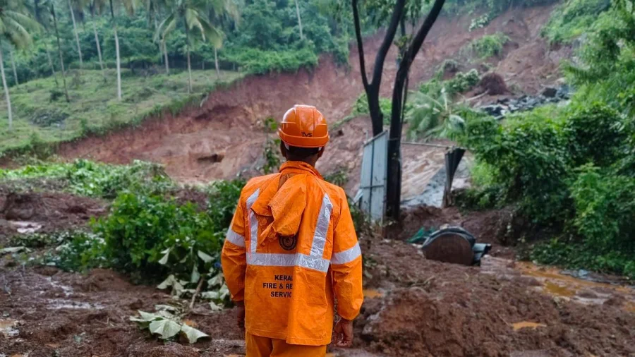
The Kerala monsoon is the state's lifeline — and, increasingly, its most dangerous season. Landslides during heavy rainfall have repeatedly turned hillsides into threats within hours. The explanation begins with one striking number: Kerala receives around 3,000 mm of rain every year, often dumped in short, violent bursts rather than steady showers. That pattern is no longer purely natural weather. It carries a climate signal.
3,000 mm of rain, and the problem is how fast it falls
Kerala's annual rainfall is among the highest in India. But experts point to a deeper issue: the rain arrives unevenly, with long dry stretches broken by intense, high-intensity spells. For the soil on Kerala's steep slopes, those bursts are the real threat. When rain falls in hours rather than weeks, the ground simply has no time to absorb it.
What happens beneath the surface before a slope gives way
When soil becomes waterlogged, it grows heavier and loses the friction that holds it to the slope. Gravity takes over, and the saturated mass slides downhill with the force of wet concrete. This mechanism is why Kerala's hilly terrain — from Western Ghats ridges to midland slopes — carries far higher risk than its coastal plains.
The climate change factor: why the monsoon is intensifying
According to the original analysis, global warming and climate change are making Kerala's high-intensity rainfall spells more frequent and extreme. The physics is straightforward: warmer air holds more moisture, so monsoon clouds carry heavier loads. When they release that load, the downpours are more violent — and the slopes below must absorb a bigger shock each time.
Who pays the price: hillside communities and monsoon travellers
The human impact of monsoon landslides falls hardest on people living on or below unstable slopes. Hillside settlements, roads carved into terrain, and construction that cuts into the ground all add to the exposure. Travellers heading to Kerala's hill stations during the monsoon also take on risk, with road blockages and slope failures possible with little warning.
What the authorities are up against
For disaster management agencies, the challenge is twofold: predicting where rain will fall and predicting which slopes will fail. Meteorological systems can track monsoon bursts, but landslide warnings depend on soil moisture, terrain mapping, and ground observations. Officials typically respond with evacuation notices and travel advisories as risk rises — but timing remains everything.
What is confirmed, and what is still unclear
What is confirmed in the source material: Kerala receives around 3,000 mm of annual rainfall; the rain falls in uneven, high-intensity spells; and climate change is increasing the frequency and extremity of these spells. What remains unclear: the specific locations, damage, or human toll of any individual landslide event, which must come from official on-ground reports. This explainer establishes the meteorological context; readers should follow government updates for the latest situation on the ground.
The bigger picture: extreme monsoon volatility across India
Kerala's experience fits a national pattern. Climate models show India's monsoon becoming more volatile — fewer rainy days, but significantly more rain falling on those days. That shift raises landslide and flood risks simultaneously, in states from Kerala to the Himalayan foothills. The common driver is the same: a warming atmosphere intensifying the water cycle.
Practical steps for residents during intense monsoon spells
Heed red alerts and evacuation notices even if the sky looks clear overhead — rain upstream can still saturate slopes above you. Avoid travel on hilly roads during and immediately after heavy rain. Watch for new cracks in soil, tilting trees, or sudden changes in stream water, which are classic precursors to slope movement. In landslide-prone terrain, preparation is the first line of defence.
What Kerala needs next: the preparedness agenda
The state's future safety depends on scaling up three essentials: landslide susceptibility maps covering every vulnerable slope, real-time rainfall and soil moisture monitoring, and