Summary
Forest officials in the Erode Division have launched a major plan to stop forest fires before they start. The new strategy uses a mix of modern technology, physical watch towers, and community help to protect large areas of woodland. These steps are being taken to keep wildlife safe and prevent the loss of valuable trees during the dry season. By training local people and using satellite data, the department hopes to respond to any smoke or flames within minutes.
Main Impact
The primary goal of these measures is to reduce the damage caused by seasonal wildfires. When a forest fire spreads, it destroys the homes of animals and ruins the air quality for nearby villages. By intensifying prevention efforts, the Erode Division is creating a safety net for the environment. This proactive approach means that instead of just fighting fires, the team is working to stop them from ever becoming large enough to cause serious harm. This shift saves money, protects biodiversity, and keeps the local community safe from the dangers of smoke and heat.
Key Details
What Happened
The Forest Department has started a new program that focuses on early detection. In the past, fires were often reported only after they had grown quite large. Now, the department is using digital tools to track heat signatures from space. As soon as a high temperature is detected in a specific area, an alert is sent to the mobile phones of forest rangers. This allows them to reach the spot quickly before the wind can spread the flames.
In addition to digital tools, the department is building and repairing fire watch towers. These towers are placed on high ground, giving staff a clear view of the forest canopy. Guards stay in these towers during the hottest parts of the day to look for smoke. This human oversight acts as a backup to the satellite systems, ensuring that no fire goes unnoticed.
Important Numbers and Facts
The Erode Division covers a vast area that includes parts of the Sathyamangalam Tiger Reserve and other protected zones. During the summer months, temperatures in these areas can rise significantly, making the dry grass very easy to burn. The department has identified several "hotspots" where fires are most likely to occur based on data from previous years. Extra staff members have been moved to these high-risk zones to provide 24-hour monitoring. Training sessions have also been held for hundreds of field workers to teach them the latest fire-fighting techniques, such as creating "fire lines" which are gaps in vegetation that stop a fire from moving forward.
Background and Context
Forest fires are a natural risk in many parts of India, but they have become more frequent due to changing weather patterns. In the Erode region, the forests are home to many important species, including tigers, elephants, and leopards. A single large fire can destroy the food sources and water holes these animals need to survive. Furthermore, many people live on the edges of these forests. Their livelihoods often depend on the forest, and a fire can threaten their homes and livestock. Understanding these risks is why the government is spending more time and money on prevention rather than just reaction.
Public or Industry Reaction
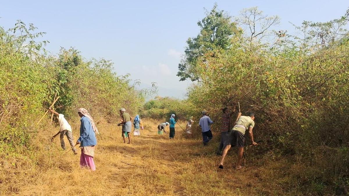
Local communities have reacted positively to being included in the prevention plan. In many villages, "Forest Protection Committees" have been formed. These groups consist of local residents who know the land well. They are being paid or given incentives to help clear dry leaves and report any suspicious activity, such as illegal campfires. Environmental groups have also praised the move to use satellite technology. They believe that using data to predict where fires might start is the smartest way to manage large natural areas with limited staff.
What This Means Going Forward
The success of this program in Erode could lead to similar systems being used across the entire state. If the number of fires drops this year, it will prove that technology and community involvement are the best tools for forest management. The department plans to continue upgrading its equipment, possibly adding drones to help scout difficult terrain. In the long term, these measures will help the forest grow thicker and healthier, which helps the planet by soaking up more carbon dioxide from the air. The focus will remain on staying alert and making sure that every small spark is put out immediately.
Final Take
Protecting our natural world requires a mix of smart technology and hard work on the ground. The Erode Division is showing that by preparing early and working with local people, it is possible to keep forests safe even during the hottest months. This effort is not just about saving trees; it is about protecting the entire balance of nature for the people and animals who call the forest home.
Frequently Asked Questions
How does technology help find forest fires?
Officials use satellite data that detects heat on the ground. When a "hot spot" is found, an automatic message is sent to forest rangers so they can check the area immediately.
What is a fire watch tower?
A fire watch tower is a tall structure built in the forest. A person stays at the top to look for smoke across the trees, helping to spot fires that might be hidden from the ground.
Why is the local community involved in fire prevention?
Local people live closest to the forest and are often the first to see a problem. By training them and giving them a role, the Forest Department can cover more ground and respond to emergencies much faster.